
SARTrack Search and Rescue
features
The SARTrack program was originally designed in 2007 for a Search and
Rescue group in New Zealand, based on the Amateur Radio APRS protocol
for Tracking and communications.
In
the beginning of 2012 I decided to develop an international version,
for the Amateur Radio (HAM) community, and SAR groups in other parts of
the world.
The current version is used by several thousand HAM's and SAR people around the globe.
It can be used in HAM mode or SAR mode. In SAR mode, all special Search and Rescue related functions become available.
At the time of writing, SARTrack is now a full software
package including all Operational Managment and Team Tracking requirements for SAR (and related)
organisations.
This document will outline only the SAR specific features currently available in SARTrack.
SARTrack
is developed to be used in the field, without any Internet access
available. Maps and other data are stored locally on the laptop, and
can be used off-line. It is assumed that multiple laptops are normally
in use at a remote location, connected together by a local LAN/WIFI
access point.
In
the intended situation, one laptop will be set up as the "server". This
Laptop should always be available immediately when an operation starts.
All other SARTrack laptops will connect to this server, which on the local LAN is automatic and does not require any TCP/IP setup.
However,
if the Local Database Server has Internet access, all data (from all
local Clients) will also be available to the outside world, using the
Master Internet Server.
SARTrack
has established two such servers, one for New Zealand only, and one
located in the Germany for general SAR use.
SARTrack is an "Un-docked" MS-Windows application, which
means all Windows (Maps, Operations Log, TimeLine, etc.) can be displayed if
required on seperate monitors, specifically, a video projector. Also,
as all SARTrack computers are linked together, you can have a Map on
one laptop, the Operations Log on another, and the TimeLine on yet another.
They will all stay in sync while they are connected to the Server.
SAR Group ID and Encryption.
All data between the Clients and Servers is encrypted during transport.
When
using a connection to the Amateur Radio APRS-IS network, APRS Messages
are by default encrypted, and require a SARTrack Client on the other
side be be able to read them.
Tracking and Objects.
Aside
from the Amateur Radio APRS Tracking features (using a TNC or the
APRS-IS network) SARTrack can also decode many commercial
VHF radios with a build-in GPS tracker.
Currently
supported interfaces are: Kenwood
FleetSync, Icom, Tait, Motorola, Hytera. SARTrack also supports AIS
(vessel) tracking. And it supports several Satellite based tracking
systems (which require Internet access).
In addition, it is possible to import GPS tracks from hand-held GPS devices into SARTrack.
SARTrack will convert all tracking data into APRS Objects, which
will then be displayed on all connected SARTrack PC's Maps (local or
remote) complete with Tactical callsign and mulitcolor Tracks.
All manually added Objects also have a Tactical callsign and a separate track color.
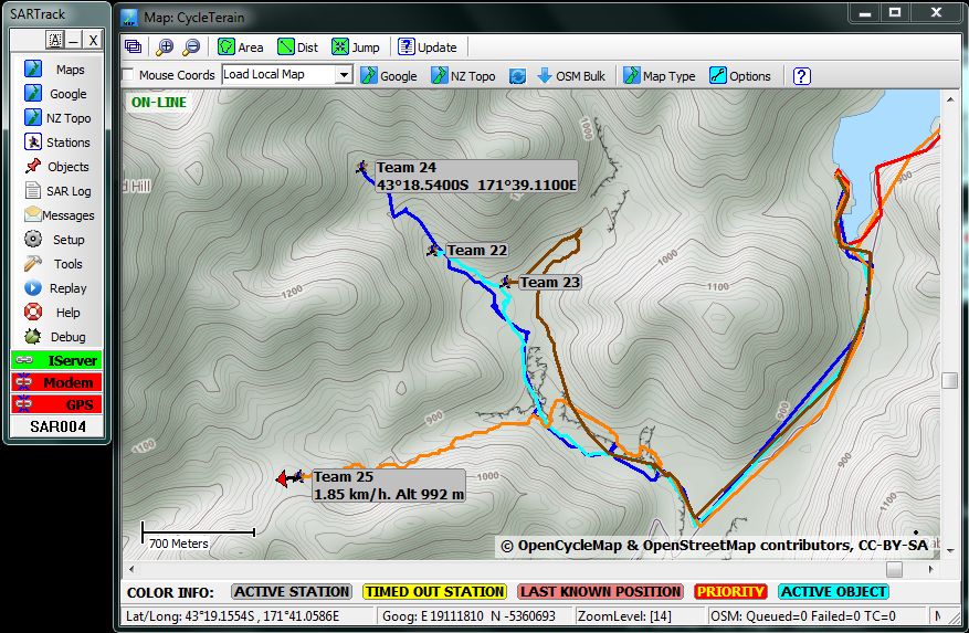
Search Areas.
On a map, Search Areas can be drawn (with Tactical name and color), which will then show on all connected PC's.
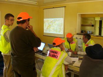
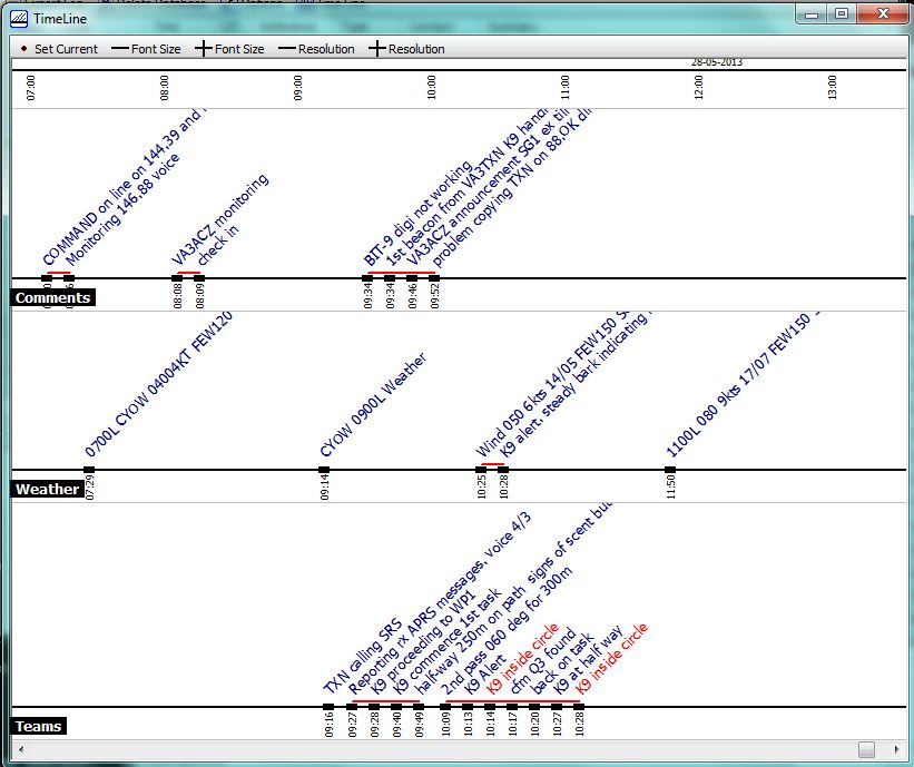
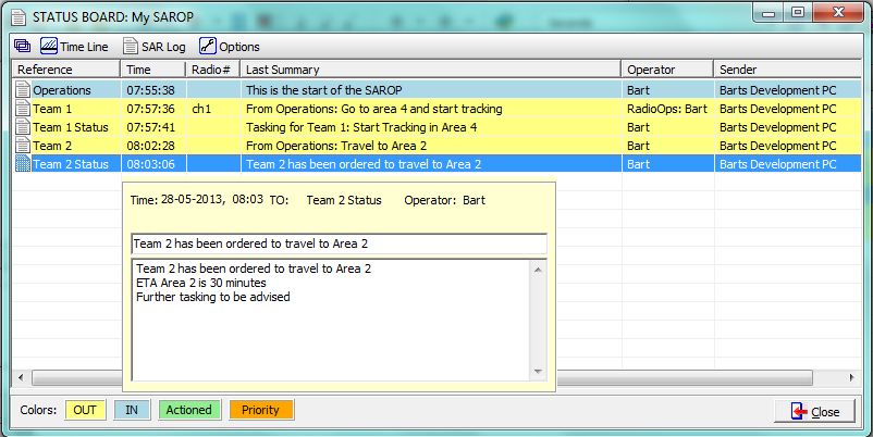
The SAR Operations Log.
Possibly the most powerfull feature of SARTrack is the Operations Log.
Currently
the Operations Log enables you to enter all operational actions on the Log. A
special Radio Operator screen is available to quickly transfer radio
communications from Teams in the field to and from the Operations
team. All LOG entries can be marked as Actioned when processed.
All Messaging and many other events are logged automatically
in the background. So, a full and complete SAROP Log is produced, which
is available for later evaluation and possible Police and coroner
inquests.
The Standard Operations Log window (sequential)

The TimeLine ("whiteboard") window.
The Status window.
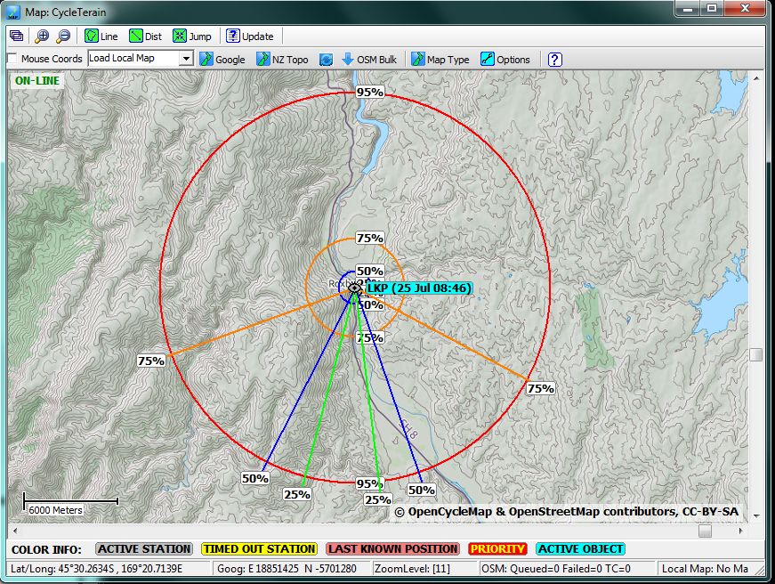
Statistical Rings and Dispersion Angles
Based on the International Search & Rescue Incident Database (ISRID) and the book Lost Person Behavior by Robert Koester, SARTrack can now display a Statistical Ring system, including (optional) Dispersion lines.
Also
optional is a 'Travel Circle' which shows an expanding circle based on
estimated speed since Last Seen (not shown on example).
For a full explanation with screenshots, click here.
This document is by no means complete, please do view the other documents available on the SARTrack website.
Updated September 2019,
Bart Kindt
CEO, SARTrack developer