|
The SARTrack
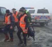
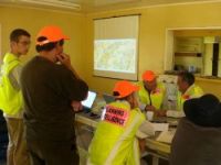
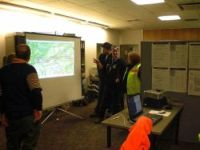
Software: The Maps in the SARTrack client are based on the OpenStreetMap (OSM) system, and there are many different maps available, including topograpical and satellite maps. In addition to this the Canadian 'Toporama' system is supported. And, 'local' maps can be installed on a Client, based on a well known APRS map format. The SARTrack client can not only decode APRS radio trackers; SARTrack can now directly decode and Track commercial radios with build-in GPS from Tait, Icom, Kenwood, Motorola and Hytera. In addition it can decode vessel AIS data (either direct via an AIS receiver or an AIS website) and several Satellite Tracking systems. All these will be overlaid on the Map, and in case of SAR setup, via the Database Server(s) will show live on all connected clients. SARTrack is designed to manage Teams in the field, in situations where Internet may not be available, communications are limited to Radio, and the local computer network is based on a locally set up WIFI system. As such, SARTrack is also perfectly suited for use in emergencies (Storms, earthquakes, etc.) where on-the-ground management and tracking of Teams is required, but the infrastructure is down. The SARTrack management is based around a Log system, which is also used as a communication system between Management and Radio operator, and which has many additional features. A Team Management system allows Teams to be assigned with People, Equipment and Tasks. Equipment can be assigned on the fly by Barcode scanning when it is handed out, and even can automatically link any Radio Tracker to the Team at this point, for tracking on the Map. An Operation Period system is available to assign managers to the Operation, and to do a handover to the next management team in multi-day operations. Missing Person forms can be used to store detailed information, including the international 'Search Urgency' calculation. A Red Cross welfare checking system (for use in emergencies) is under development. The Android App is currently in Beta testing. It allowes a person or Team to be tracked via the App, send and receive Messages and receive Tasks, take photo's (of Clue's) and when linked to a person, allowes this person to edit his/her own personal details in the Database, including setting his/her Availability into the future. When the App has Internet access, all data is uploaded to the system live (including its location and any Clue's/Photos taken). If no Internet is available, the App will automatically upload all its collected data to the Local Database Server when it comes back into range of the local WIFI. To download the software, please click on the 'Download' link on the left. SAR users, please carefully read the documentation on the Homepage, especially on the setup and layout of the Database Systems. Please make a donation to support the ongoing development, on the Donations Page. Last updated 26 October 2020. |

|
|||||||||||